Fishtank Learning
7th Grade Math
Unit 5: Percent and Scaling
Lesson 15
Objective
Use scales in maps to find distances between locations on the map or in real life.
Warm Up
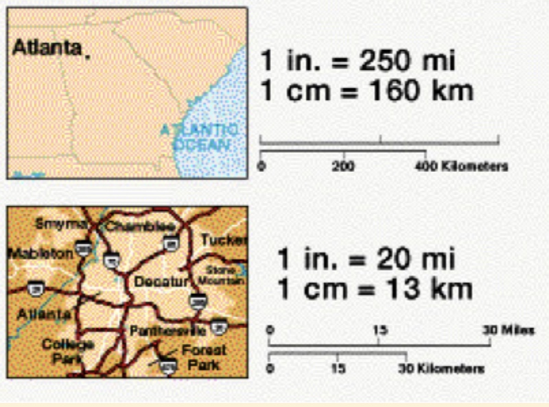
The images below are maps with different scales. What do you notice? What do you wonder?
 |
 |
Anchor Problems - Problem 1
Cory is looking at a digital trail map of a local park. On the map, a trail segment is 2 inches long. The scale of the map says: 1 inch = 200 feet.
a. How long is this trail segment in real life? Show your reasoning.
b. Cory zooms to 160% on the digital map to see more detail.
- What is the new scale of the map after zooming in?
- How long will the same trail segment appear in the zoomed-in image?
Anchor Problems - Problem 2
The map below shows Boston Common and Boston Public Garden. Perla walked around the outside perimeter of the Common and the Public Garden. About how far did she walk?

Anchor Problems - Problem 3
Your school used to provide a map of the building for new students, but the original version was lost. You and your classmates are trying to draw a new one. Here’s what you remember:
- The scale on the map was $$ \frac{1}{4 }$$ inch = 20 feet.
- On the map, the music room and art room were 5 inches apart.
- The cafeteria and the gym were $$2 \frac{1}{4 }$$ inches apart on the map.
Additionally, you measure some other distances:
- The distance between the library and the auditorium is 140 feet.
- The distance from the main office to the cafeteria is 350 feet.
a. Brainstorm mathematical questions that you could answer with the information provided.
b. Select two mathematical questions to answer from your list and solve them using proportional reasoning.
c. It takes about 140 steps to walk from the bus drop-off to the science wing. If each step is roughly 2.5 feet, about how far apart are these locations in real life? How far apart would they be on the map?
Problem Set
Target Task
The image below is a map of the park around Cruz Playground in Philadelphia, Pennsylvania. Approximate the actual distance around the park.
